

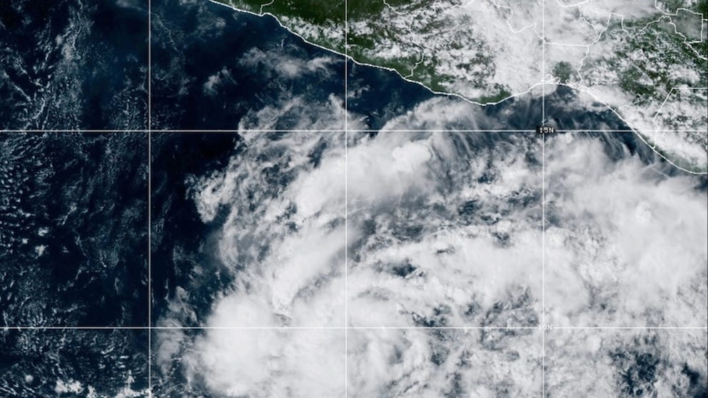
Tropical Storm Vance officially formed in the eastern Pacific Ocean on Wednesday, developing from Tropical Depression Twenty-Two-E. According to the National Hurricane Center, the storm is currently churning about 520 miles south of Acapulco, Mexico, and remains far over open water.
The cyclone organized with the help of a strong Tehuantepecer wind event blowing across southern Mexico, which fueled thunderstorms in the region. Vance is currently producing maximum sustained winds of roughly 40 mph. Its formation marks a minor meteorological milestone, as it becomes the first “V-named” storm in the eastern Pacific basin since 2018.
Fortunately for coastal residents, the system poses no immediate threat to land. Current forecast models suggest Vance will track in a general northwestward direction over the open ocean in the coming days.
Meanwhile, on the other side of the globe, weather watchers are tracking a far more severe system. Super Typhoon Champi remains an exceptionally dangerous and powerful storm in the western Pacific. Producing catastrophic maximum sustained winds of 185 mph with gusts reaching up to 225 mph, the Joint Typhoon Warning Center currently projects Champi will approach Japan over the weekend, though it is expected to weaken somewhat before making any potential landfall.